When carrying out a drone roof survey, the first step is to clearly define the survey’s scope. It is important to carefully plan the flight path and perform a detailed pre-flight inspection. Maintaining a safe distance from obstacles throughout the flight ensures smooth operation. Specialized drones equipped with high-quality cameras, LiDAR sensors, and GPS technology provide precise data collection, which is vital for accurate analysis and decision-making. In contexts where safety and security are priorities, such as construction sites or commercial properties, the presence of certified private security guards can add an extra layer of protection during survey operations. Prioritizing safety measures, such as clearing the area, checking the drone’s condition, monitoring weather, and adhering to regulations, is necessary for successful and responsible surveying.
Advantages of Drone Roof Surveys
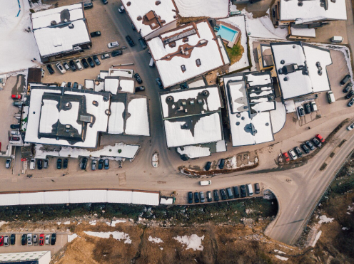
Drone roof surveys greatly improve the efficiency of inspecting and assessing rooftops for damage or maintenance needs. With high-resolution cameras, drones capture detailed images of the roof’s condition without the risks involved in manual inspections. This method speeds up the assessment process, saving valuable time and resources. Drones are capable of reaching difficult or hazardous areas like steep or unstable roofs, which are often unsafe for personnel. The extensive aerial footage captured offers a comprehensive view of the roof’s overall health. Additionally, this approach minimizes the chance of injury to workers, making it a safer alternative to traditional inspection methods.
Technology Used in Drone Surveys
Drone roof surveys rely on a blend of advanced equipment and software to gather detailed imagery and data effectively. High-resolution cameras and specialized sensors, including LiDAR (Light Detection and Ranging), play a significant role in producing accurate aerial footage of roofs. Thermal imaging cameras help detect temperature differences that can reveal problems such as water infiltration or insulation failures. GPS systems ensure precise navigation and mapping. The collected data is then processed using dedicated software, which creates 3D models, orthomosaics, and detailed reports to help identify defects and plan maintenance with confidence.
Process of Conducting a Survey
Conducting a drone roof survey requires thorough preparation and precise execution. Defining the survey’s scope helps identify the exact areas of the roof to be inspected. Planning the drone’s flight path ensures full coverage of the targeted sections. A comprehensive pre-flight check guarantees that the drone is fully operational before the survey begins. During the flight, maintaining a safe distance from obstacles and adhering to the predetermined flight path are essential. After data collection, analyzing the gathered information allows for an accurate assessment of the roof’s condition. Attention to detail and following the planned steps closely are crucial to a successful drone roof survey.
Importance of Accurate Data Collection
Collecting accurate data is fundamental for reliable and precise information during a roof survey. The data serves as the foundation for all subsequent analysis and decision-making. Ensuring precision in data collection means the insights derived are dependable and actionable. Measurements regarding roof dimensions, material conditions, and potential problems are critical for creating effective maintenance plans or deciding on repairs and replacements. Faulty data can result in incorrect evaluations, leading to unnecessary expenses or missed issues. Using advanced drone technology enhances both efficiency and accuracy, delivering detailed information essential for thorough evaluation. The quality of data directly impacts the survey’s success and outcome.
Safety Measures During Surveys
Ensuring safety during drone roof surveys is essential to protect both personnel and equipment. Before starting, confirm that the area is free of people to avoid accidents. Conducting a pre-flight check helps verify that all drone systems are functioning correctly. Maintaining a safe distance during takeoff and landing reduces the risk of injury. Monitoring weather conditions closely is necessary, and flights should be avoided during high winds or poor weather. Having a first aid kit on site prepares the team for unexpected situations. Lastly, complying with local regulations and securing necessary permits is vital for a safe and legal operation.
Applications of Drone Survey Data
Data from drone surveys allows for the accurate identification of structural concerns and supports efficient planning for maintenance or repairs. The information collected can be used to build detailed 3D models of the roof, detect water pooling or leaks, assess material conditions, and estimate the extent of damage. Analyzing these details enables professionals to prioritize repairs based on urgency, ensuring cost-effective maintenance. Furthermore, drone data supports monitoring the progress of maintenance work over time, helping to track improvements and extend the roof’s lifespan. Overall, the use of drone survey data significantly improves the accuracy and effectiveness of roof maintenance planning.
Related Topics: